


APPLICATIONS

Rail Industry
Whether you’re looking to increase capacity, allow for higher line speeds, or upgrade and expand a rail network, you will need the rail section to be surveyed in order to get an up-to-date digital view. Busy rail lines need this to be done without shutting down rail traffic, while keeping the survey crew out of harm’s way, and all this without losing any data precision. Using traditional surveying methods, it could take weeks or even months to complete the scanning project and it would likely require service interruptions.
Instead, surveyors need a more innovative approach. By attaching an Applanix POS LV with LiDAR onto a rail car, the surveyor gets a Mobile Mapping System that can successfully map tracks, clearances, vegetation growth, and fixed assets along a rail corridor. All this without traffic interruption or sacrificing accuracy.

Mobile Mapping
3D Mobile Mapping is on track to change the way we understand our world. The advanced hardware and software available has revolutionized the way we visualize, measure, analyze, and catalogue our environment. This technique involves surveying from a moving vehicle, often at a high speed, with integrated scanning and imaging technology to collect dense point cloud data. This data is then combined with rich imaging to create detailed visualizations of formerly inaccessible areas. Even in areas that were previously easy to survey, mobile mapping has improved efficiency and productivity while decreasing costs by making it possible to complete week-long projects in days. A highly accurate mobile mapping solution will allow you to capture data quickly but it will also simplify post-processing by not requiring excessive point cloud correction (ie. removing duplicate objects).
The Applanix POS LV position and orientation solution enables rapid data collection of imagery and laser mapping data to create a database for subsequent rendering for city modeling, infrastructure development and management (such as bridges and overpasses), asset management, and environmental simulations to prevent damage from natural disasters.

Fleet Management
With increased traffic and the growing demand for tracking and streamlining vehicle use, companies need a way to track the position of real-time assets. Whether in busy urban city centres or in more remote regions in the countryside, it is vital to be able to track the position of every moving asset. This could include their position, orientation, and their compliance with the load balancing of the network, and it could even be used to avoid obstacles and prevent accidents. The tracking systems need to successfully work in tunnels, rail yards, areas with dense canopies, high-rise corridors, and areas with high risks of GNSS outages.
This solution would not require as high accuracy as mobile mapping or track geometry, for example, and our Applanix POS LVX series comes in at a lower price point without sacrificing the ruggedness of the solution.

Pavement Management
When managing pavement in high-traffic areas, safety and maintenance are the most important issues. A solution needs to quickly and efficiently monitor the conditions of roads and highways in order to schedule appropriate maintenance intervention, without disrupting the traffic and creating congestion. Pavement management can be done at the same time as infrastructure maintenance, with both the ground and any neighbouring structures captured at once. This is especially important in places like airports where the runways are subject to constant stress and the nearby structures are crucial to overall safety.
The Applanix POS LV integrated with a LiDAR solution enables automatic geo-tagging of all the key functional parameters of pavement in a single pass. Cracking, rutting, texture, potholes, bleeding, shoving, raveling, and roughness can all be captured lane by lane while the post-processed image connects adjacent lanes with minimal misalignment.
Reduce the cost,
keep the accuracy
Our GNSS-inertial solutions for mobile mapping enable you to collect the most accurate geospatial data with the lowest possible collection costs.
With over 30 years of experience in developing and producing solutions for mobile mapping, Trimble’s Applanix products are known globally for quality and reliability in mobile mapping solutions. But the best part is, you’ll never be on your own. Our experienced and enthusiastic engineers are always on hand to ensure your project goes off without a hitch.
Trimble’s Applanix products offer a platform upon which to base your business.
Explore the Trimble Applanix tools for enabling automatic data collection and map generation.
Wondering which system is best suited to your needs?
Let our experts find the perfect solution for you.
HARDWARE
Introducing the new AP+ Land, our lightest and most powerful boards for OEM integration

Trimble
AP+ Land OEM Boards
Accurately and efficiently track and monitor fleets, produce high-definition (HD) maps and 3D models, or act as a reference solution for advanced driver-assistance systems (ADAS) testing, no matter the GNSS environment.
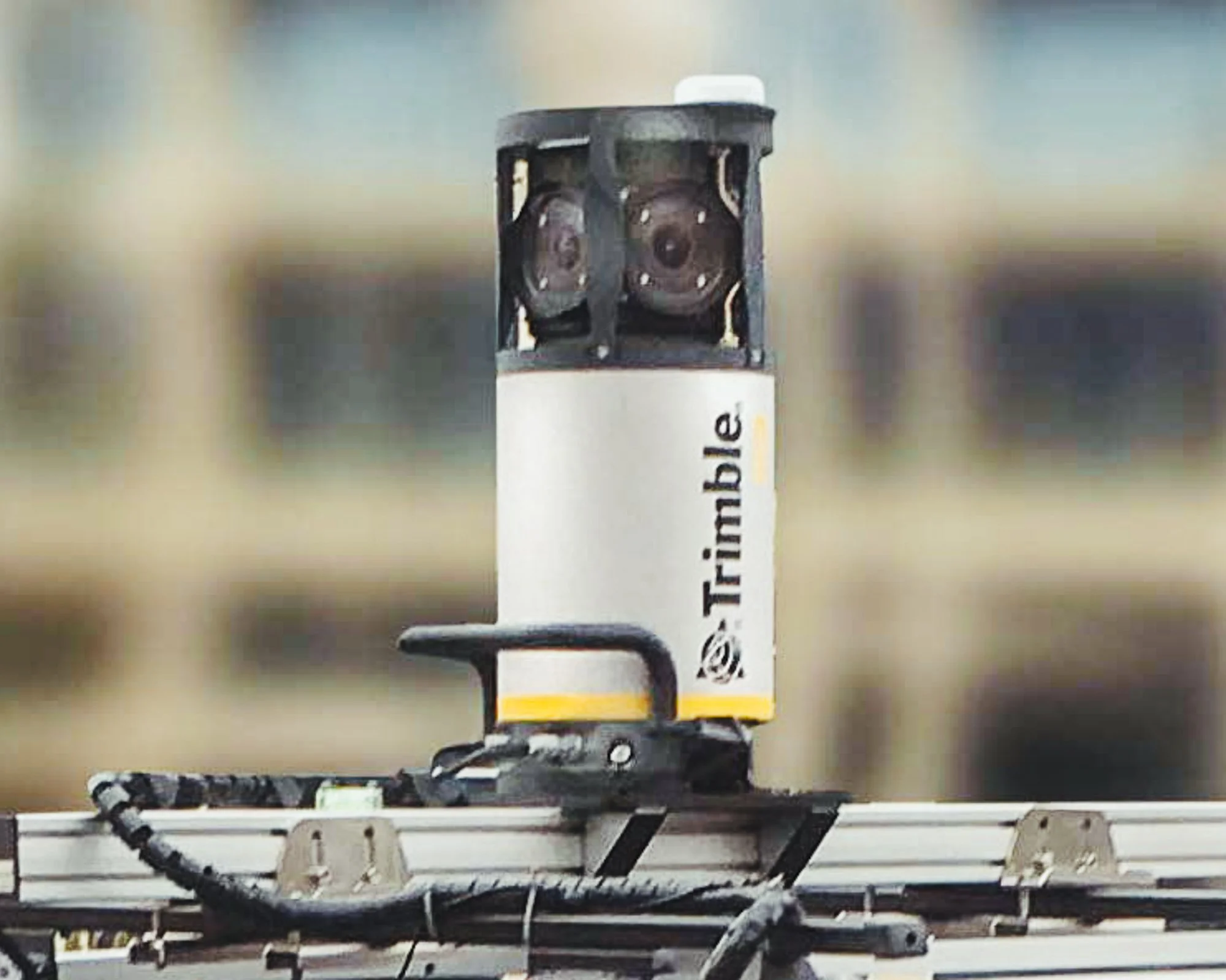
Two is better than one with the new Applanix POS LVX series
Applanix POS LVX
Housed in a robust, rugged enclosure and easily incorporated into small vehicles, autonomous platforms, and tight spaces of all types, it is designed for the smaller, modular mobile mapping system.
Available data sheets
Applanix POS LVX 120 Applanix POS LVX 125

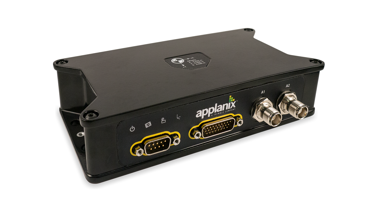
Applanix POS LV
Designed to operate under the most difficult GNSS conditions found in urban and suburban environments, the Applanix POS LV enables accurate positioning for road geometry, pavement inspection, GIS database and asset management, road surveying, and vehicle dynamics.
Available data sheets
Applanix POS LV

Trimble RT200
Maximize your real-time applications with the Trimble RT200, the Trimble Applanix POS LV variant designed for those who demand precision and reliability. Featuring all the standard functionalities of Applanix POS LV, the RT200 elevates your experience with its high G IMU, ensuring unmatched accuracy and performance in the most demanding environments. Choose RT200 for a seamless integration into your real-time applications.

APX-18 Land
The Trimble APX-18 Land is an OEM GNSS-inertial solution with dual GNSS antenna input, that enables a new class of small, portable mobile mapping systems.
Available data sheets
APX-18 Land
SOFTWARE
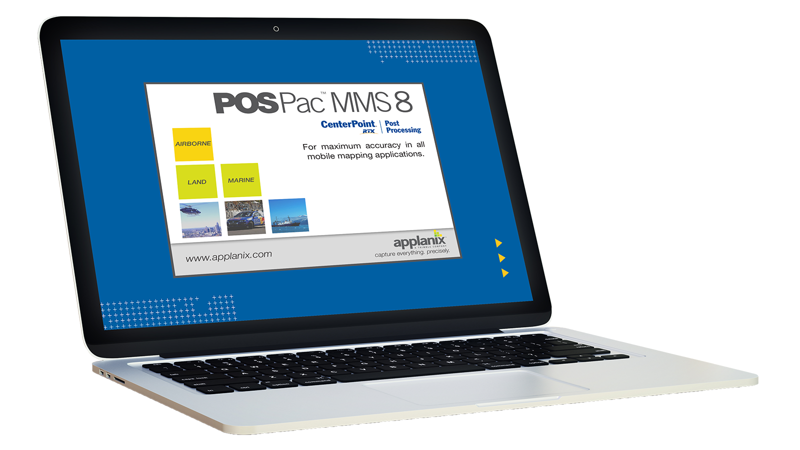
Applanix POSPac MMS
Increase your mobile mapping accuracy with our powerful post-processing software, specifically designed to work with both the Applanix POS LV and Trimble AP+ Land OEM line of products.

Applanix LIDAR QC Tools
Improve the accuracy and reliability of mapping with LiDAR platforms and achieve the highest level of georeferencing accuracy with LiDAR sensors. Applanix LIDAR QC Tools smooths and perfects your LIDAR point cloud, ensuring your final result has the highest accuracy.
SUPPORT

Customer Support
Add our expertise to your team. Our industry-leading customer support team is here to help you take your project from its inception all the way through to the final result.

Customer Story
Fraunhofer
Working with Fraunhofer IPM, Trimble’s Applanix POS LV with POSPac Seamlessly Integrates into Customized Vehicle for Highly Accurate Mobile Mapping

Customer Story
ROMDAS
Airport Tarmac Safety Initiative Takes Off with Precise GIS Mapping Data from ROMDAS and Applanix POS LVX

Customer Story
Railergy
Learn how Railergy’s Autonomous Rail Solutions Rely on Trimble’s Applanix POS LV

Customer Story
Sabre-scan
Learn how Sabre-scan integrated with Applanix OEM boards to create a high-performance mobile mapping system and redefine mobile mapping.
Customer Story
Trimble
Trimble worked with ESRI to create a mobile mapping system that used AI to locate the exact position of water meters in Charlotte, North Carolina.
-
All of our webinars can be found in our easy-to-access webinar dashboard.
-
You can find more customer stories in our Customer Story Hub.
-
You can find White Papers and Articles in our Articles Hub.

Overview
Mobile Mapping
Brochure
Portfolio
Product Comparison

Mobile Mapping
Solutions Webpage

WANT TO LEARN MORE?
Let us show you how Trimble’s Applanix mobile mapping solutions can help grow your business.
Give us a little information about yourself and your needs and an Applanix Mobile Mapping specialist will reach out to you with a personalized solution.